
Nature & Hikes
Monk’s Trail Chiang Mai: Wat Pha Lat Hiking Route in Doi Suthep
Plan Monk’s Trail in Chiang Mai with clear route notes for Wat Pha Lat, the Doi Suthep continuation, trailhead access, conditions and preparation.
14 min read
By Daniel Calleja, founder of The Chiang Mai Brief and Chiang Mai resident.
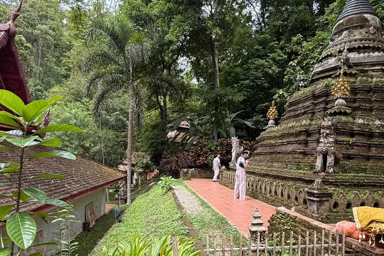
Monk’s Trail Chiang Mai, often referred to as The Monk’s Trail, is one of the city’s most accessible hillside walks: a shaded forest route marked by orange monk robes, leading from the Suthep area to the peaceful grounds of Wat Pha Lat. For first-time visitors, The Monk’s Trail offers a straightforward introduction to Chiang Mai hiking, with a clear route and a rewarding temple stop. Most hikers turn around there after roughly 45–60 minutes uphill, while stronger, better-prepared walkers can continue on towards Wat Doi Suthep.
This guide covers where to find the trailhead, how far each option is, what the climb feels like and how to navigate The Monk’s Trail confidently. Expect uneven paths, humidity and steep sections rather than a casual city stroll, but also a welcome escape from Chiang Mai’s traffic without needing a full day in the mountains. It sits under our nature and hikes hub.
Key takeaways
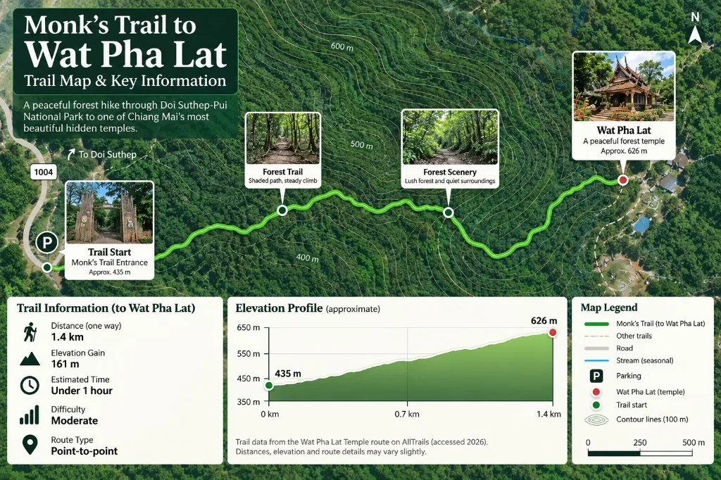
- Hike about 1.4 km one way from the trailhead to Wat Pha Lat, with roughly 161 m of elevation gain and typically under an hour of walking.
- Wat Pha Lat is the best turnaround for most visitors; treat Doi Suthep as a separate half-day hike.
- Navigate directly to the mapped Monk’s Trail trailhead behind the Chiang Mai University area; the entrance is easy to miss if you are expecting a large English sign.
- Wear grippy closed-toe shoes and download an offline map; roots, loose soil and rain create slippery footing.
- Carry at least one litre of water, start early, and avoid continuing uphill late or in heavy rain.
- Respect Wat Pha Lat as an active temple: dress modestly, stay quiet and remove shoes in sacred buildings.
Monks Trail Chiang Mai: Wat Pha Lat or Wat Doi Suthep?
Monks Trail Chiang Mai is often described as a single hike to Doi Suthep, but it is more useful to treat it as two distinct outings. The Monk’s Trail starts near the end of Suthep Road, close to Chiang Mai University; this is the usual starting point for the forest climb to Wat Pha Lat. This first section is the practical choice for most visitors: a relatively short, rewarding hike with clear purpose, manageable distance and a temple that feels integrated with the hillside rather than separate from it.
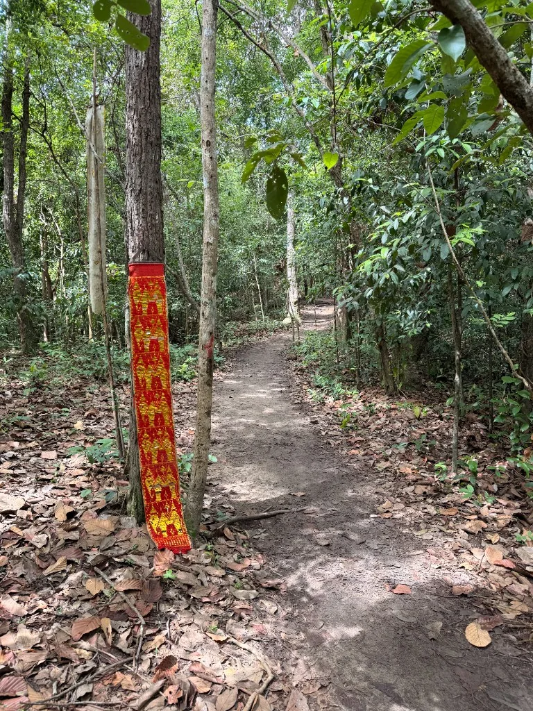
From the commonly used trailhead, the route to Wat Pha Lat is about 1.4 kilometres one way and typically takes under an hour, depending on fitness, heat and trail conditions. The route gains roughly 161 metres in elevation. It is uphill throughout, with some steep, uneven stretches over exposed roots, loose soil and rock. Orange fabric strips tied to trees have traditionally marked parts of The Monk’s Trail, but they should be treated as reassurance rather than a substitute for navigation. Download an offline map before setting out, particularly in the wet season when side paths and leaf cover can make the route less obvious.
Wat Pha Lat is the natural turnaround point for a half-day plan. Allow time to look around respectfully: this is an active Buddhist site, not simply a hiking viewpoint. Dress modestly, keep voices low and avoid walking into residential or worship areas unless access is clearly appropriate. The descent follows the same route and deserves care, as downhill footing can be more slippery than the ascent after rain.
The continuation from Pha Lat to Wat Phra That Doi Suthep is considerably more demanding and should not be assumed to be a straightforward extension. For walkers taking on this upper section, The Monk’s Trail becomes a longer mountain route rather than a short temple hike. For context, the longer AllTrails route that continues towards Doi Suthep is listed at about 7.6 kilometres with roughly 617 metres of elevation gain and is rated hard. The upper route is steeper, less consistently marked and more affected by seasonal growth. Some walkers instead follow or cross sections near the mountain road; that option requires extra caution around traffic and should not be undertaken late in the day. For a road-based temple visit without the hike, see our Doi Suthep visitor guide.
For most independent visitors, the sensible plan is to hike to Wat Pha Lat early in the morning, then return to the city. Choose the longer Doi Suthep route only with adequate water, proper walking shoes, offline navigation, daylight to spare and confidence on sustained uphill terrain. There are no reliable facilities on the forest section, so carry at least one to two litres of water, rain protection in the green season and a charged phone. Whether you stop at Pha Lat or continue to Doi Suthep, this is hiking rather than a casual temple stroll: preparation makes the route safer and far more enjoyable.
Monks Trail options: Wat Pha Lat vs Wat Doi Suthep
| Route option | Approximate distance from lower trailhead | Estimated elevation gain | Typical one-way time | Trail difficulty and navigation | Best suited to |
|---|---|---|---|---|---|
| Wat Pha Lat turnaround hike | About 1.4 km | About 161 m | Typically under 1 hour | Uphill throughout; steep, uneven sections over roots, loose soil and rock. Orange markers help; offline map recommended. | Most visitors wanting a short, rewarding half-day hike. |
| Full continuation to Wat Phra That Doi Suthep | About 7.6 km for the longer listed route | About 617 m | Allow several hours | More demanding: steeper terrain, less consistent marking, seasonal growth. Needs offline navigation, water, proper shoes and daylight. | Confident walkers ready for sustained uphill and a longer forest hike. |
Monk’s Trail Distance, Elevation and Difficulty
The Monk’s Trail is one of the most accessible forest walks from central Chiang Mai, but its difficulty depends on where you finish. The standard route runs from the trailhead off Suthep Road, the usual starting point for the hike, to Wat Pha Lat, while the longer monk’s trail continuation climbs onward to Wat Phra That Doi Suthep. These should be treated as two distinct hikes when planning time, fitness and supplies.
From the trailhead to Wat Pha Lat, the route is about 1.4 kilometres one way, or roughly 2.8 kilometres if you return by the same trail. Allow under an hour for the uphill walk, depending on pace and trail conditions, with approximately 161 metres of elevation gain. The route follows a shaded forest path, marked in many places by the orange fabric ties traditionally associated with monks’ routes. It is a manageable introduction to hiking above the city, though it is not a paved park walk: expect uneven earth, exposed roots, loose stone and short steeper stretches.
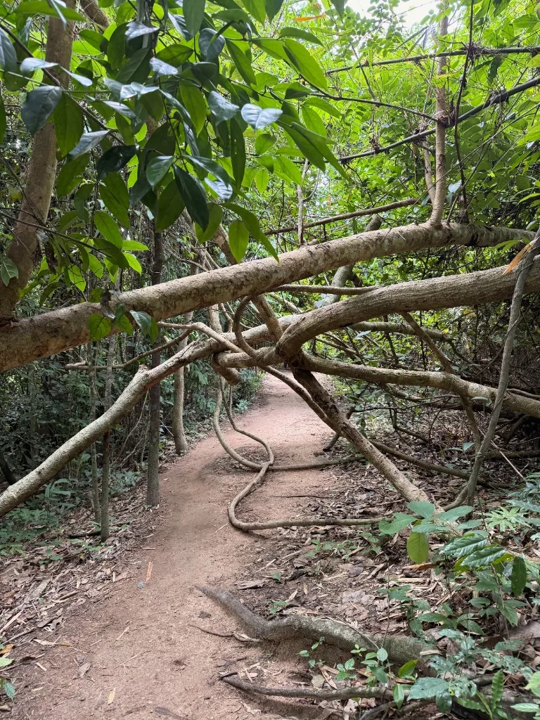
The first section is generally suitable for reasonably active visitors, including families with older children, provided everyone has stable footwear. Hiking shoes or trainers with proper grip are preferable to sandals. In the dry season, the path is usually firm underfoot, although leaves and dust can obscure rocks and roots. During or after rain, parts of the trail can become muddy and slippery, particularly around shaded gullies and the small stream crossings. Slow down on descents; wet stone near the waterfall and temple grounds can also be slick.
The continuation from Wat Pha Lat to Doi Suthep is considerably more demanding. For context, the longer route we reviewed in AllTrails is about 7.6 kilometres with roughly 617 metres of elevation gain in total. This upper section is steeper, rougher and less straightforward to navigate than the walk to Wat Pha Lat. It suits hikers comfortable with sustained climbing and uneven natural terrain, rather than those looking for a short temple stroll. Allow several hours for the longer route, with additional time for rests, route checks and your return or transport down.
An early morning start is the most practical choice, particularly from February to May, when exposed sections become hot later in the day. Carry sufficient water for the full plan: Wat Pha Lat is a place to pause, not a reliable resupply point, and the longer route requires more than a casual bottle. Check the weather before leaving, avoid the trail in heavy rain or thunderstorms, and turn back if conditions deteriorate. For many visitors, the trailhead-to-Wat Pha Lat section offers the right balance of distance, shade and manageable elevation; reaching Doi Suthep is a separate half-day hiking objective.
Monk’s Trail planning checklist
- Choose your finish: Wat Pha Lat is a short forest hike; Doi Suthep is a longer half-day objective.
- Allow under an hour uphill to Wat Pha Lat, covering about 1.4 kilometres one way.
- Expect roughly 161 metres of elevation gain to Wat Pha Lat, with roots, loose stone and uneven earth.
- For the longer Doi Suthep route, plan several hours; the AllTrails route we reviewed is about 7.6 km with roughly 617 m of elevation gain.
- Wear trainers or hiking shoes with reliable grip; avoid sandals on muddy, rocky or slippery sections.
- Start early in hot months, carry enough water, and do not rely on Wat Pha Lat for resupply.
- Check conditions before leaving; avoid heavy rain or thunderstorms and turn back if weather worsens.
How to Find the Monk’s Trail Entrance
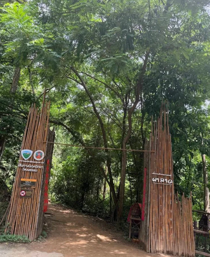
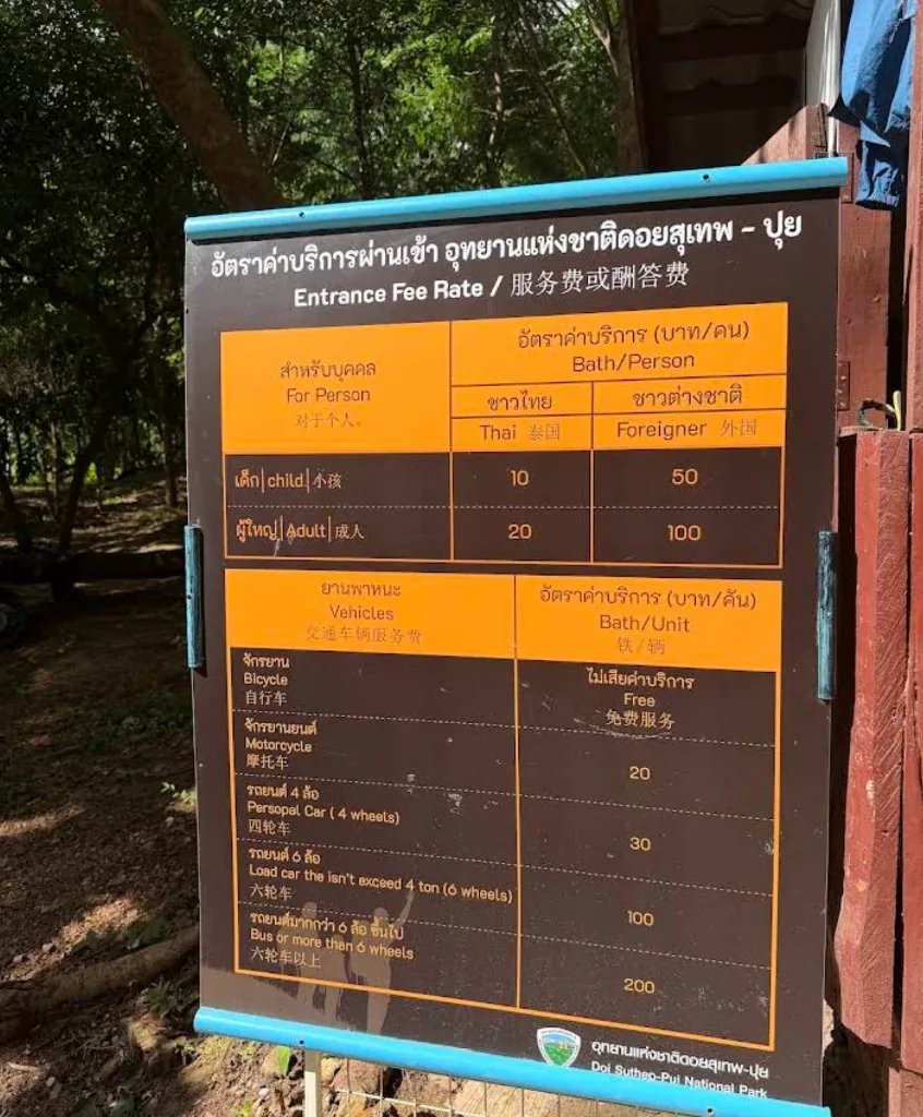
The main Monk’s Trail entrance is on the lower slopes of Doi Suthep, behind the Chiang Mai University area and south of the rear side of Chiang Mai Zoo. The final approach is easy to miss if you are expecting a large English sign saying “Monk’s Trail”. The most reliable approach is to navigate directly to the mapped Monk’s Trail trailhead rather than using Wat Pha Lat itself as your destination, because the temple also has a separate road entrance higher on the mountain. Near the start, look for the trail entrance and the orange cloth markers associated with the route. This is worth checking carefully before you set off, as finding the correct starting point can be more confusing than following the trail once you are on it. Since 1 October 2025, Doi Suthep-Pui National Park has charged an entrance fee for the Pha Lat Nature Trail: 100 THB for foreign adults, 50 THB for foreign children, 20 THB for Thai adults and 10 THB for Thai children. This is a trail or national-park charge, not a Wat Pha Lat temple entrance fee.
Hiking from the trailhead to Wat Pha Lat
Monk’s Trail is the short forest hike linking the Chiang Mai foothills to Wat Pha Lat, a quiet wat on the lower slopes of Doi Suthep. From the usual trailhead, allow under an hour uphill, depending on pace and ground conditions. The path is generally clear but uneven, with exposed roots, loose earth and sections that become slick after rain. The orange cloth markers help confirm the route, but downloading the trail in AllTrails before setting out provides useful additional navigation on an unfamiliar hike. Carry water: the stream and small waterfall beside the temple are not drinking-water sources. Start early for cooler conditions and a calmer walk; after rain, wear shoes with reliable grip and take extra care on the steeper, shaded sections. At Wat Pha Lat, dress respectfully, keep voices low around the temple buildings, and allow time to explore the peaceful grounds before continuing uphill or returning by the same route.
At Wat Pha Lat: temple grounds, access and etiquette
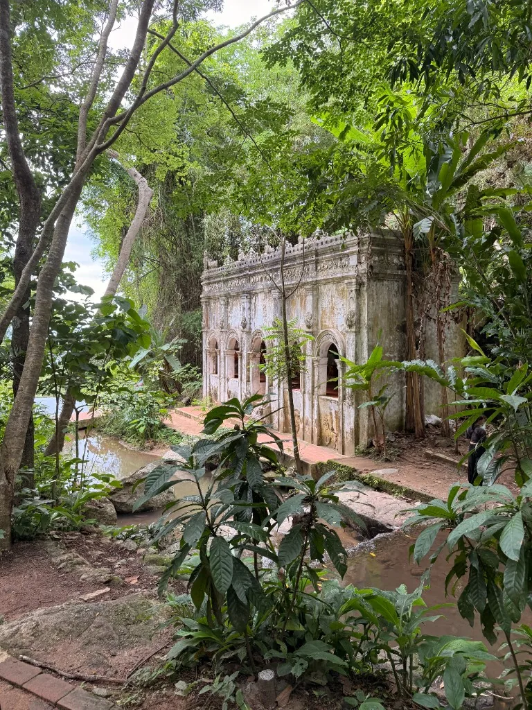
Wat Pha Lat is an active forest temple, not simply a viewpoint or a stop on a temple tour. Its name is sometimes written as Wat Pha Lat or Wat Pha Lad, and it should not be confused with Wat Phra That Doi Suthep, the larger temple farther up the mountain. The grounds sit beside a stream, with mossy stonework, modest shrines, monk residences and paths leading between different levels of the site. Visitors are welcome to explore respectfully and at an unhurried pace.
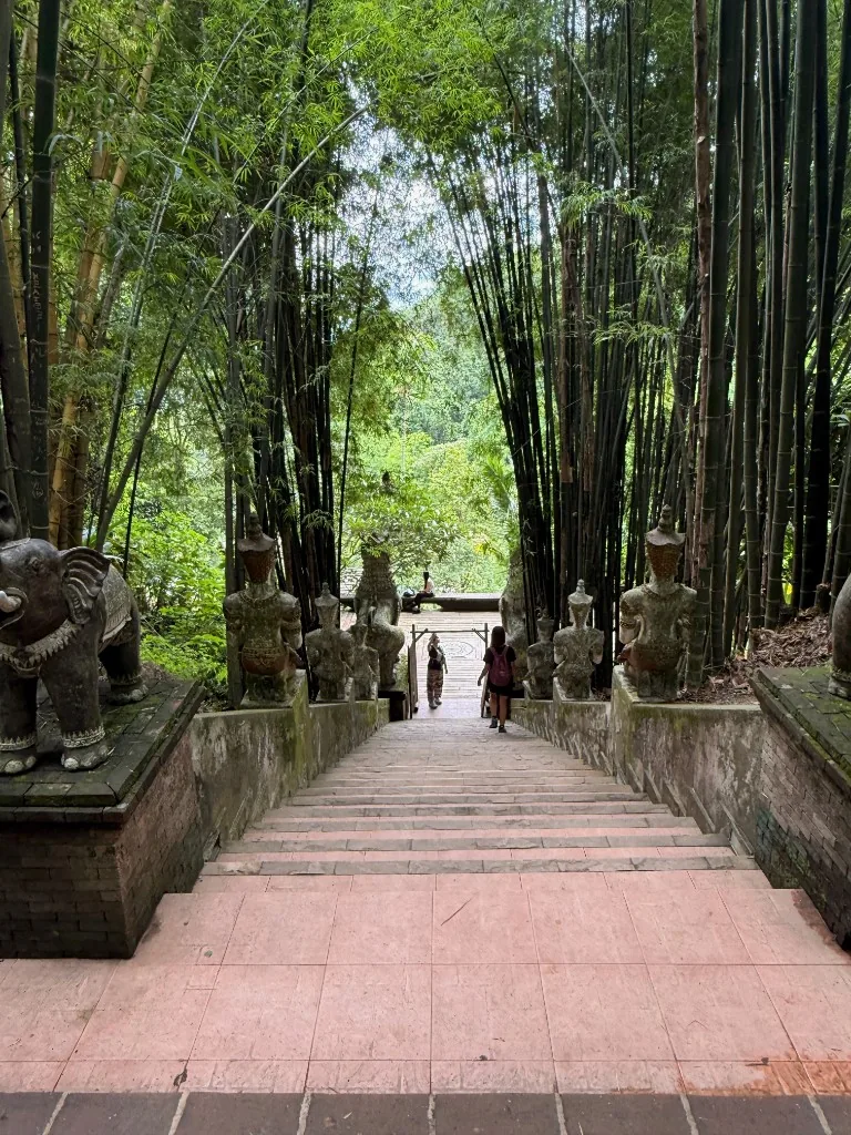
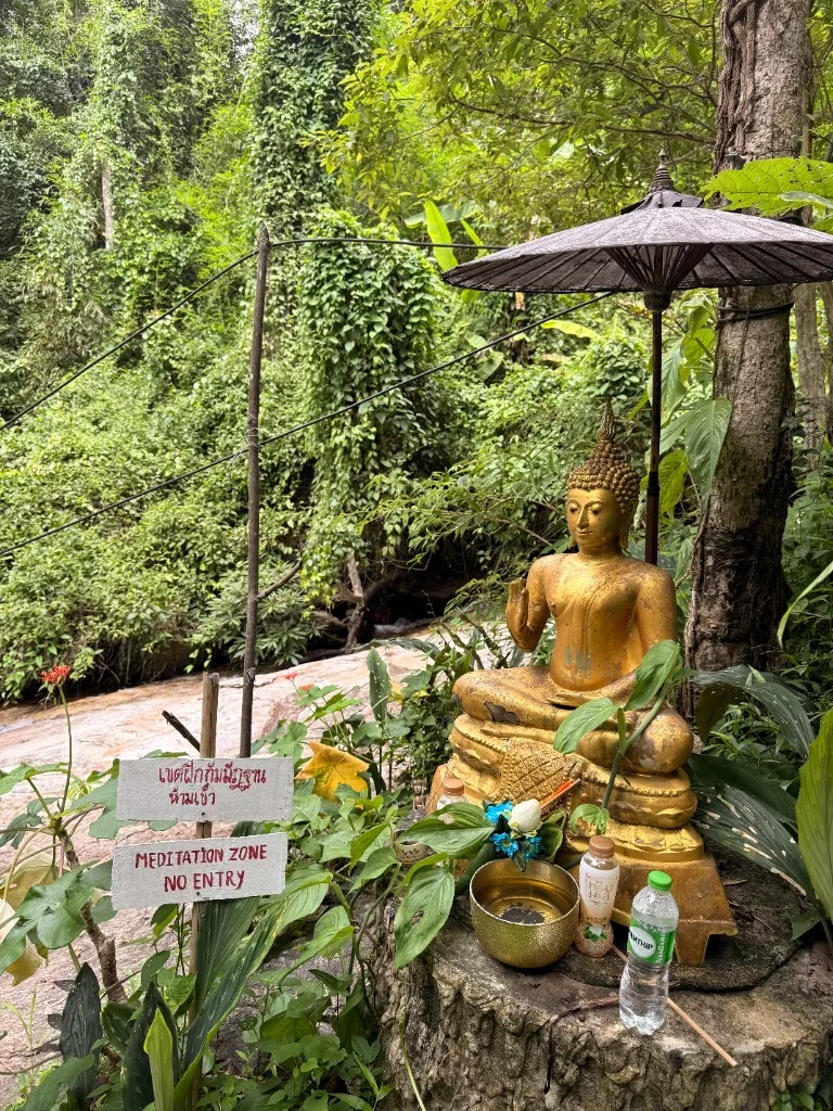
Wat Pha Lat itself is generally free to enter, although access rules and national-park charges associated with the hiking trail can change. Check current trail information before setting out. Donations at the temple are welcome where collection boxes are provided, but they are voluntary. Access from Monk’s Trail brings hikers into the lower part of the temple grounds; a road also reaches the wat, so expect occasional cars, songthaews and visitors arriving without hiking. The site is usually most comfortable to visit in the morning, before the day’s heat and before larger groups arrive, although opening arrangements can change around religious events.
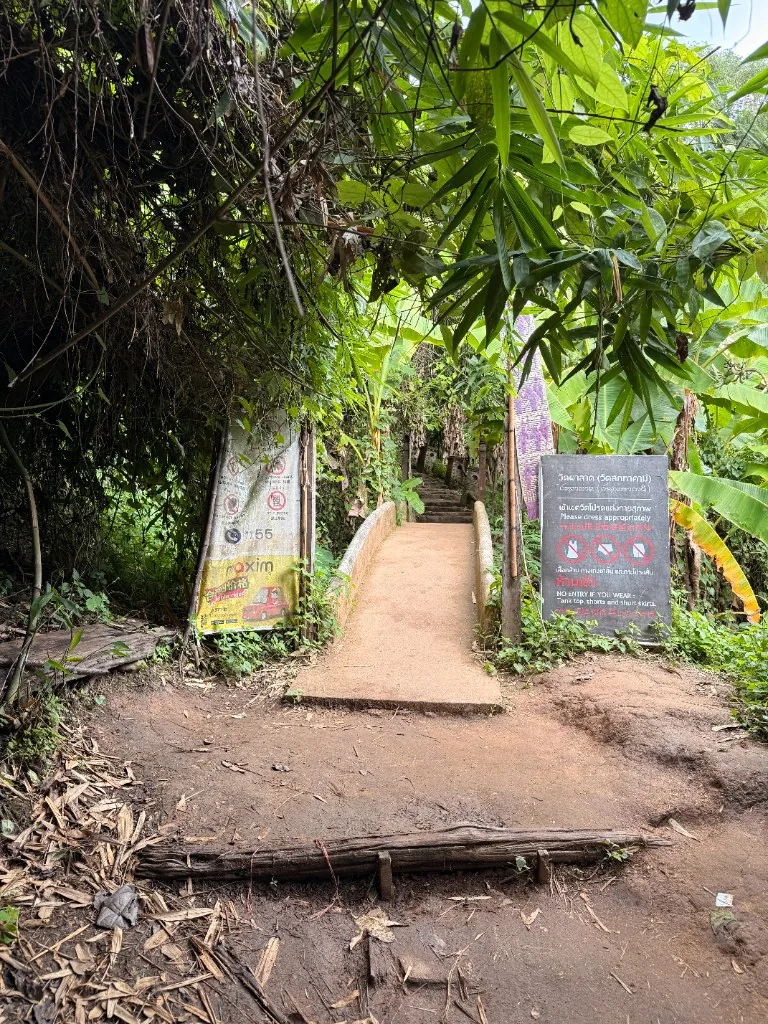
Dress as you would for any Buddhist wat: cover shoulders and knees, and avoid tight or revealing hiking clothing when possible. Remove shoes before entering any indoor shrine, ordination space or clearly marked sacred building. Keep voices low, do not climb on statues or historic structures, and do not point feet toward Buddha images. If monks are present, give them space and avoid interrupting prayers, work or private areas. Women should not touch monks or hand objects directly to them. For broader temple visit guidance, see our temple etiquette and dress code guide.
- Dress modestly, with shoulders and knees covered.
- Remove shoes before entering marked sacred buildings.
- Keep voices low and give monks space.
- Stay on established paths around wet stone and roots.
- Carry out wrappers and bottles.
The stream and waterfall area can look inviting after rain, but treat it as part of the temple environment rather than a swimming spot. Stay on established paths, particularly where wet stone, roots and fallen leaves make footing unstable. Pack out snack wrappers and bottles; there are limited waste facilities, and water runoff feeds the forest below.
For most walkers, Wat Pha Lat is the natural finish of Monk’s Trail. The continuation toward Wat Phra That Doi Suthep is a separate, longer uphill undertaking and requires more time, water and navigation confidence than the trailhead-to-temple hike.
Wat Pha Lat visitor checklist
- Visit in the morning for cooler temperatures, quieter paths and fewer tour groups.
- Wear clothing covering shoulders and knees; choose practical hiking clothes that remain respectful.
- Remove shoes before entering shrines or marked sacred buildings, and keep voices low throughout the grounds.
- Stay on established paths: wet stone, roots and leaves can make streamside sections slippery.
- Do not climb on statues, point feet toward Buddha images, or treat the waterfall area as a swimming spot.
- Give monks privacy, especially during prayers or work; women should not touch monks or pass objects directly.
- Bring out all bottles and wrappers, as waste facilities are limited and runoff flows into the forest.
From Wat Pha Lat to Wat Phra That Doi Suthep
The continuation from Wat Pha Lat to Wat Phra That Doi Suthep is a separate undertaking from the short Monk’s Trail walk. It is longer, steeper and less straightforward to navigate, with sustained elevation gain through forest before meeting access roads near Doi Suthep. Allow several additional hours rather than treating it as a quick extension. Check your water supply, weather and daylight at Wat Pha Lat before continuing. The final route may involve Suthep Road, where traffic, parking areas and ride-hailing options such as Grab make it possible to shorten the return — see our getting around guide for transport options in Chiang Mai. Treat this upper section as a separate, more demanding hike rather than a casual extension of the walk to Wat Pha Lat.
When to stop, turn back or arrange a ride down
Make the decision at Wat Pha Lat, not after fatigue has set in. For most visitors, the sensible plan is to hike from the trailhead to Wat Pha Lat, explore the grounds, then return the same way. Continuing uphill is best reserved for walkers who have allowed adequate time, carry sufficient water and are comfortable with a more demanding, less clearly signed mountain route.
Start in the morning if you intend to go beyond Wat Pha Lat. Chiang Mai’s heat builds quickly, and the forest can feel humid even under shade. An early departure also gives a useful margin if navigation takes longer than expected or rain arrives. Avoid beginning the upper section late in the afternoon: sections can be difficult to follow in fading light, and the temple complex at Doi Suthep is not a substitute for a planned hiking finish.
- Turn back if the ground is muddy or slippery, especially after sustained rain. Roots, rock slabs and leaf-covered slopes can become unstable, while small crossings and drainage lines may carry more water than expected.
- Stop if anyone in the group is moving slowly from heat, cramp, dizziness or low water. There is no advantage in pressing on simply because Wat Phra That Doi Suthep appears close on a map; the remaining climb and road connections can feel substantial.
- Choose a ride down if you reach Suthep Road or the temple area and do not want to walk back. Signal can be inconsistent on the mountain, so save your destination and have a local transport backup in mind.
Hiking shoes with reliable tread are strongly preferable to sandals or smooth-soled trainers. During the dry season, footing is generally firmer, but loose dust and dry leaves can still make steep descents awkward. Carry more water than you expect to need, plus a charged phone and offline map coverage.
If you reach Suthep Road or the temple area and do not want to walk back, arrange a Grab where service is available, or use a songthaew or taxi from the Doi Suthep parking areas. A ride down is often the practical choice after the full ascent, particularly for visitors without a vehicle parked near the original trailhead.
Turn-back decision checklist
- Decide at Wat Pha Lat whether to continue; most visitors should explore the grounds and return via the same trail.
- Continue uphill only with an early start, ample water, reliable footwear, offline maps and confidence on steeper, less-signed terrain.
- Turn back after sustained rain or when mud, wet roots, rock slabs and crossings make footing uncertain.
- Stop if anyone has dizziness, cramps, overheating, unusual fatigue or dwindling water; the remaining climb can feel longer than maps suggest.
- Avoid starting the upper route late afternoon, when fading light, humidity and navigation delays reduce your safety margin.
- From Suthep Road or the temple parking area, use Grab, a songthaew or taxi for the descent if needed.
- Save your destination before hiking and keep a transport backup, since mobile signal can be inconsistent on the mountain.
Navigation, conditions and what to bring
The Monk’s Trail is straightforward in principle, but it is not a fully signed park walk. The usual monk’s trail route begins from the trailhead off Suthep Road, close to the Chiang Mai Zoo area, and follows a shaded forest path uphill to Wat Pha Lat. Orange fabric tied around trees and occasional directional markers help identify the route, although junctions can still be unclear after storms or periods of maintenance. Download an offline route before setting out: Google Maps is useful for reaching the trailhead but is less dependable once you are under tree cover, while AllTrails or another offline GPS app can provide a helpful route line. Do not rely on a live signal alone.
For the trailhead-to-temple walk, allow under an hour uphill at a typical pace, with extra time for the temple grounds and the downhill return. The continuation from Wat Pha Lat to Wat Phra That Doi Suthep is a separate, substantially more demanding undertaking. It is longer, steeper and more exposed in places, so treat it as a proper half-day hike rather than an extension to add casually after reaching the temple.
Conditions are generally most manageable during the dry season, broadly November to February, when the ground is firmer and temperatures are more comfortable early in the day. During the wet months, the trail can become muddy and slippery, particularly on steep earth, exposed roots and crossings near the stream. Even a brief shower can quickly change the footing. Closed-toe hiking shoes with reliable grip are preferable to sandals or smooth-soled trainers; they offer more security on loose soil and protect against stones, roots and insects.
Bring more water than you expect to need, at least one litre for the walk to Wat Pha Lat, and considerably more if continuing towards Doi Suthep, plus sunscreen, insect repellent, a light rain layer and a charged phone with an offline map. A small snack is sensible for the longer route. Start in the morning where possible: the forest is cooler, daylight is ample, and there is more margin if navigation takes longer than planned. Hiking alone is common, but tell someone your intended route, stay on established paths and turn back if rain, fatigue or uncertain directions make progress less safe. For longer nature days outside the city, also see our day trips and nature hub.
Trail preparation checklist
- Download an offline GPS route; tree cover can make live signals unreliable beyond the trailhead.
- Start early for cooler conditions, full daylight, and extra time if junctions or markers are unclear.
- Follow orange fabric ties and established paths, but turn back if directions become uncertain.
- Wear closed-toe shoes with dependable grip, especially after rain when roots, soil, and stream crossings become slippery.
- Carry sufficient water for the conditions and your planned route, plus sunscreen, repellent, a rain layer and a charged phone.
- Allow under an hour uphill to Wat Pha Lat; plan additional time for the temple grounds and the return.
- Treat the Doi Suthep continuation as a separate half-day hike, requiring more water, energy, and preparation.
Stay updated
Get the Chiang Mai Brief
Useful local updates, new guides, openings and practical information for living in or visiting Chiang Mai.